News
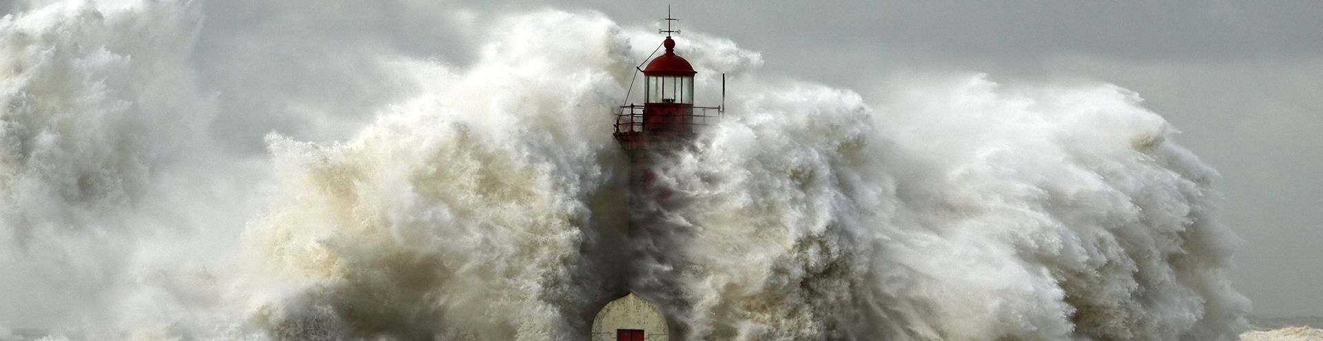
 A map of the air temperature of air over the Baltic using the WRF model (11.06.2015, 12:00)
The temperature of the air at a height of 2 m above the surface, obtained using a numerical weather model (representative of a 4×4 km area).
The air temperature is one of the basic variables in numerical weather models. The SatBałtyk system uses the WRF model (Weather Research and Forecasting), one of the most commonly used mesoscale weather models worldwide (suitable for analysing weather phenomena at a scale of several tens to several hundreds of kilometres, that is, a scale corresponding to the size of the Baltic Sea).
In the SatBałtyk System, the WRF model covers the whole area of the Baltic Sea and uses the results of a global weather model as a source of information about adjacent areas. The details of the WRF model and its configuration in the SatBałtyk System can be found here.
The SO SatBałtyk service provides distributions of air temperature over the Baltic in degrees Celsius [°C], 24 times a day, in the form of maps with a resolution of 4 km.
Methodology for determining air temperature
In the WRF model, air temperature, like all the other variables describing the state of the atmosphere, is determined on a three-dimensional grid covering the section of the atmosphere over the target area from the land/sea surface to the 50 hPa level, which lies at an altitude of approximately 20 km. The air temperatures at the various grid nodes are obtained as the solution of the equation that describes the changes in temperature in time as a result of the inflow of air with other properties, the exchange of heat with surrounding air masses and with the substrate surface and/or phase changes of the water contained in the air. For this reason, the equations describing temperature are strictly lined to those describing the dissipation of radiation and heat in the atmosphere and also to those describing physical processes taking place in clouds.
In the WRF model, the layers of the atmosphere are of different thicknesses, variable in time and space, and dependent on the land relief and the state of the atmosphere at a given place. In order to obtain the air temperature at a height of 2 m above the surface, which is a product of the SO SatBałtyk system, the model results are interpolated in the vertical.
Validation (assessment of accuracy)
The accuracy of the air temperature maps is assessed on the basis of an analysis of the differences between measured and modelled temperature values. The results of the model’s validation can be found here.
Air temperature (WRF model) (for registered users)
|
Powstańców Warszawy 55 81-712 Sopot, Poland |
|
Write to us: |

